
Land Use Planning
Land use planning is an important sphere of human activity. Its main aim is to find a way how to organize space in order to correspond all requirements of officials, society, business. Land use planning is a very complex activity. Just imagine that you need to consider all natural hazards, agriculture, soils, several industries, population, ecology, forestry etc. to outline the future development of the territory.
See more...
Such works require a team of professionals from different spheres: agriculture, soil science, biology, ecology, economics etc. Moreover it is critical to have a platform to aggregate all needed data and recommendations from the team of experts. Nowadays, the smart specialists use geographical information systems (GIS) for such tasks. Consequently, the team of professional must include GIS-specialists. They work with databases, maps, space images. Their activity allow to get not only a textual recommendations but a computer map where the client can see the actual state of the territory, needed changes, and how everything will change after project implementation.
The description above show our vision of land use planning in brief. We have an international team of experts, GIS-team. Our approach corresponds to modern practice of land use planning. We are sure that it is always possible to reach sustainable development via scientific methods.

Related Projects
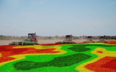
Agricultural land planning
Precision agriculture is a modern approach based on technologies which saves fertilizers and significantly reduces the amount of pollutants from th...
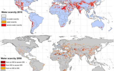
Information of wastewater is crucially vital for land use planning
Freshwater resources and population densities are unevenly distributed worldwide. Information describing current levels of wastewater generation, w...
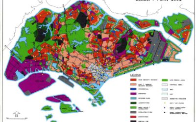
Land use planning for government and business
The economic efficiency of the use of the territory requires proper planning. The most effective tool for such planning is the geographic informati...