GIS as a tool for land use planning
Proper organization of the environment has always been necessary to ensure the safety and comfort of the population, effective economic development and other needs of society. At different stages of the development of civilization, different tasks became foreground, priorities and human capabilities changed, – accordingly, approaches to land use planning changed.
Currently, there are several important features and trends in this area. First of all, it is a focus on the concept of sustainable development, which implies a balanced consideration of economic, environmental and social aspects. Increased demands on the environment and the complex structure of society and the technosphere make this task extremely difficult, requiring the participation of many specialists. In addition, the involvement of the population of the territory in the decision-making process is becoming increasingly important. It is impossible to ensure the interaction of all participants and the processing of large amounts of different data without modern technologies. This information is mainly spatial in nature, so the use of GIS seems to be the most effective way to support land-use planning. Geoinformation technologies allow not only to combine and jointly analyze heterogeneous information, but also to model different scenarios, to coordinate individual planning decisions, to present the result in different forms and formats.
Another important feature of our time is the high rate of change in the situation, which leads to the need for rapid response and modification of projects in connection with new circumstances. For example, in Singapore, despite the approach to long-term planning, population growth and rapid development of the city lead to a rapid obsolescence of developed solutions. The current practice of updating them every ten years is not effective enough, but the more frequent revision process requires too much resources and is usually a difficult task (Fig. 1).
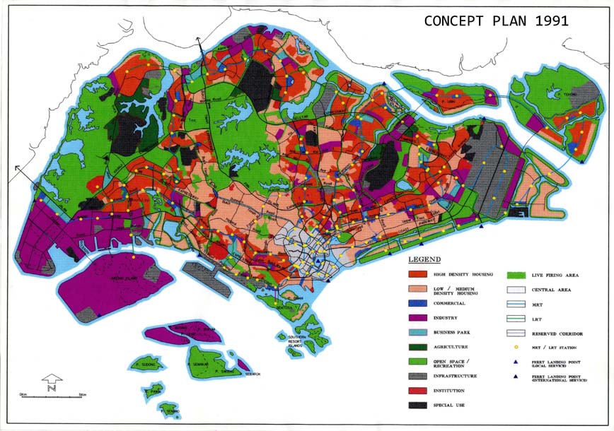
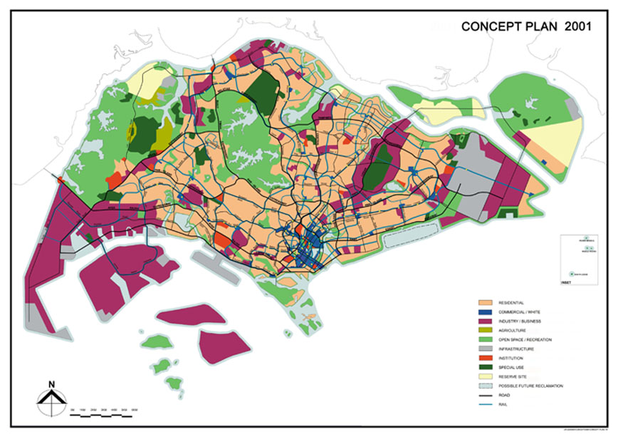
Source: https://www.ura.gov.sg/Corporate/Planning/Concept-Plan/Past-Concept-Plans
GIS technologies accelerate the process of spatial planning, but also allow you to make changes to existing forecast models, while maintaining the basic framework of the project, which reduces labor and time for its updating.
It should be noted that globalization is an important aspect of modern land-use planning. There is currently no land-use planning at the global level, but we can note its elements expressed in various international agreements, which are gaining in weight. For example, the UN Convention on the law of the sea (2) or the Ramsar Convention on wetlands (3), the sustainable development agenda (4) and many others. Such agreements have a significant impact on the economy, politics, environmental management and social processes, determine the direction and content of land use planning. The existing principles of sustainable development of territories are relevant for all countries and peoples and are directly reflected in decisions on the development of territories.
However, the choice of how to achieve the sustainable development Goals should be based on an understanding of the specifics of regional and local planning. Each district has its own natural features, history and traditions of land use, as well as its own problems. It is obvious that many land-use development solutions in Singapore are not applicable, for example, for Indonesia, which has a different economic structure and, accordingly, is focused on solving other problems (5). It is impossible to borrow experience of other territory without its adaptation. Here again, geoinformation technologies are a good basis for combining General approaches with private methods into a single system.
It should be noted that the geoinformation platform that performs all these tasks should be developed by GIS specialists purposefully and include special solutions and algorithms for planning the development of territories. When creating such a platform in accordance with high scientific and technical requirements, as well as with the correct organization of the process of its use, the territorial planning process reaches a qualitatively new level.
References
- Long-Term Land Use Planning In Singapore / http://shinbint.com/writing/Landuse_Case.pdf
- United Nations Division for Ocean Affairs and the Law of the Sea / https://www.un.org/Depts/los/convention_agreements/texts/unclos/closindx.htm
- Ramsar Convention / https://www.ramsar.org
- The Sustainable Development Agenda / https://www.un.org/sustainabledevelopment/development-agenda
- Land Use System Approach to Sustainable Land Management in Indonesia / http://wgbis.ces.iisc.ernet.in/energy/HC270799/LM/SUSLUP/Thema3/645/645.pdf